 ar
ar bg
bg hr
hr cs
cs da
da nl
nl fi
fi fr
fr de
de el
el hi
hi it
it ko
ko no
no pl
pl pt
pt ro
ro ru
ru es
es sv
sv tl
tl iw
iw id
id lv
lv lt
lt sr
sr sk
sk sl
sl uk
uk vi
vi et
et hu
hu th
th tr
tr fa
fa ms
ms hy
hy ka
ka ur
ur bn
bn mn
mn ta
ta kk
kk uz
uz ku
ku
Inclinometer-based Hydrostatic Leveling System
Data acquisition for Kingmach Inclinometer-based Hydrostatic Leveling System can be arranged as manual checking, remote digital collection, or a mixed program. JMDL-47XXAT can be read by comprehensive testers or connected to automatic acquisition for remote transmission. JMDL-62XXADT, JMQJ-62XXADT, and JMYC-62XXAD provide RS485 output, which helps when several hydrostatic channels need to be read from a cabinet or platform. JMCJ-1003/1005 remains a field-reading instrument for magnetic ring depth and groundwater level confirmation. The acquisition plan should define sampling interval, channel address, unit display, reference point, abnormal-data review, and power backup. Manual readings are still useful after storms, construction impacts, cabinet faults, or unexpected curve jumps because they can confirm whether the instrument, reference, or site condition has changed. Good data handling also needs versioned baseline records, clear point names, and visible maintenance notes. Without that discipline, a long settlement curve may look complete but still be hard to trust during engineering review.


Application of Inclinometer-based Hydrostatic Leveling System
Building projects use Inclinometer-based Hydrostatic Leveling System when a foundation, basement, column line, retaining wall, or adjacent ground area needs a dated vertical movement record. The work often starts before the permanent structure is complete: excavation, dewatering, pile work, concrete loading, and backfilling can all change elevation patterns. Kingmach JMDL-47XXAT is relevant to pile foundation settlement and base uplift in deep foundation pits, while JMDL-62XXADT or JMQJ-62XXADT hydrostatic sensors can compare several building points from one reference. A useful layout may follow a gridline instead of only the most visible cracks, because differential movement across a structural bay is often more important than one isolated value. The record should connect each channel to a floor level, nearby column or wall mark, construction date, water condition, and visual inspection note. If one side of a basement drifts while another remains steady, the trend can guide more focused review. For occupied buildings, stable wiring, protected cabinets, and clear point labels matter because readings may continue through many inspection cycles.
The future of Inclinometer-based Hydrostatic Leveling System
The future of Inclinometer-based Hydrostatic Leveling System will include cleaner digital handover records. Settlement monitoring often lasts longer than the construction team stays on site, so owners need more than a table of values. A useful handover file should include model, serial number, range, reference point, tube route, ring depth, baseline, installation photo, cable tag, borehole number, and first stable reading. Kingmach products such as JMDL-47XXAT and JMCJ-1003/1005 especially benefit from this because embedded rods, magnetic rings, anchors, and borehole readings may be hard to inspect later. When that information is stored with the curve, maintenance teams can understand why a point was installed and how its settlement should be interpreted years later. Future records should make the instrument history as visible as the measurement itself, so old readings can still be trusted after staff changes, repairs, and new construction stages.
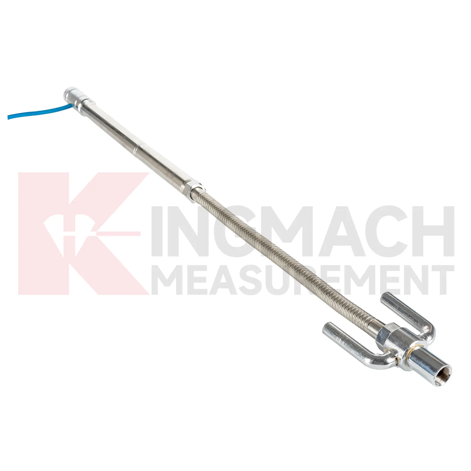
Care & Maintenance of Inclinometer-based Hydrostatic Leveling System
Embedded Inclinometer-based Hydrostatic Leveling System such as JMDL-47XXAT require protection during earthwork, paving, and later traffic. The settlement plate, measuring rod, metal flexible conduit, anchor head, extension rod, bottom anchor, and side-exit cable should be installed without being bent or crushed by compaction equipment. Record installation depth, gauge length, cable exit point, fill layer, protection cover, and first stable reading before the point is buried. During maintenance, inspect accessible cable sections, junction boxes, cabinet terminals, and any area where later excavation may have disturbed the line. If a curve changes after a filling stage or pavement operation, compare the timing with construction logs before judging the ground response. Buried parts are difficult to inspect after coverage, so photographs, as-built sketches, and cable route notes become part of the working instrument. Good embedded-point care is mostly quiet prevention done before damage becomes visible.
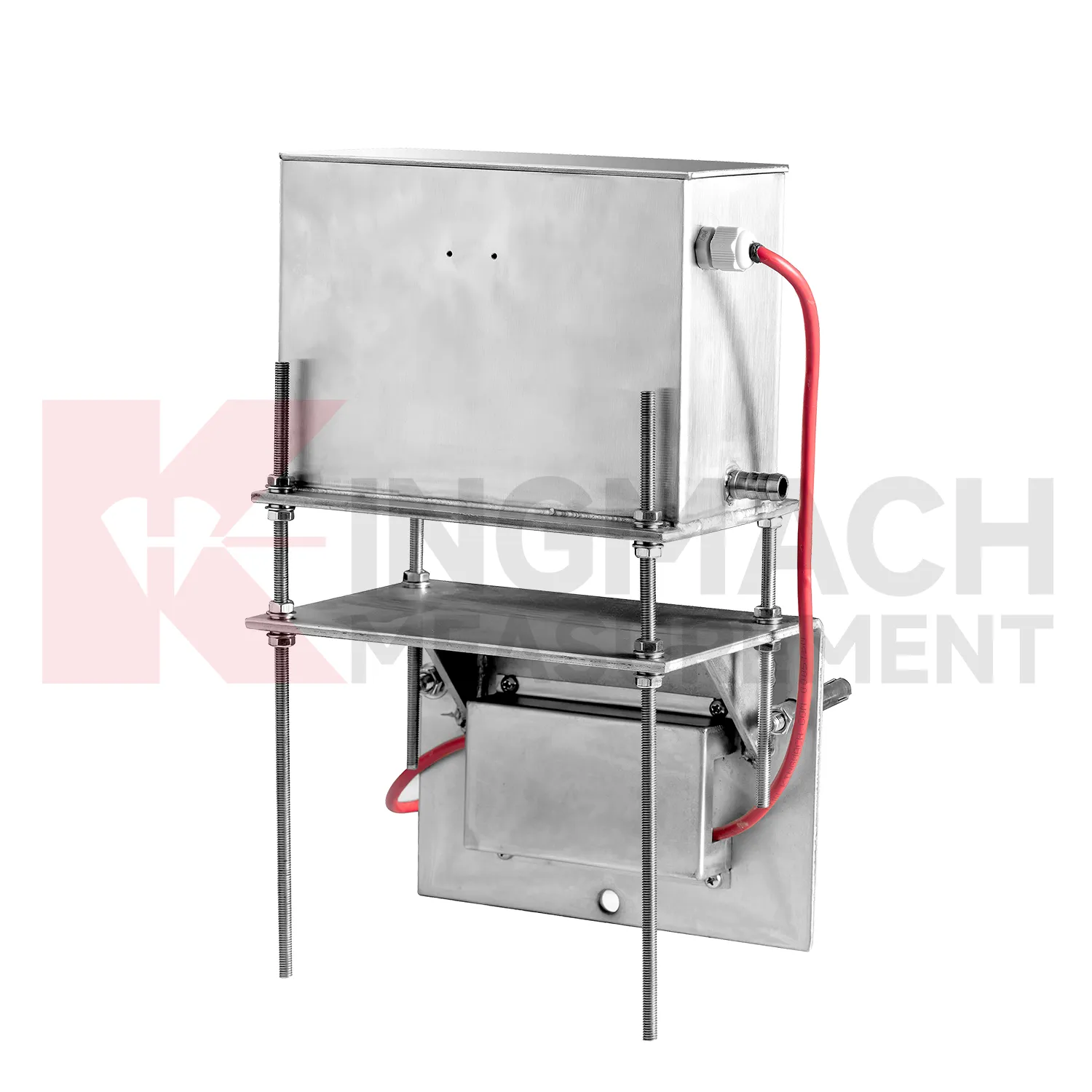
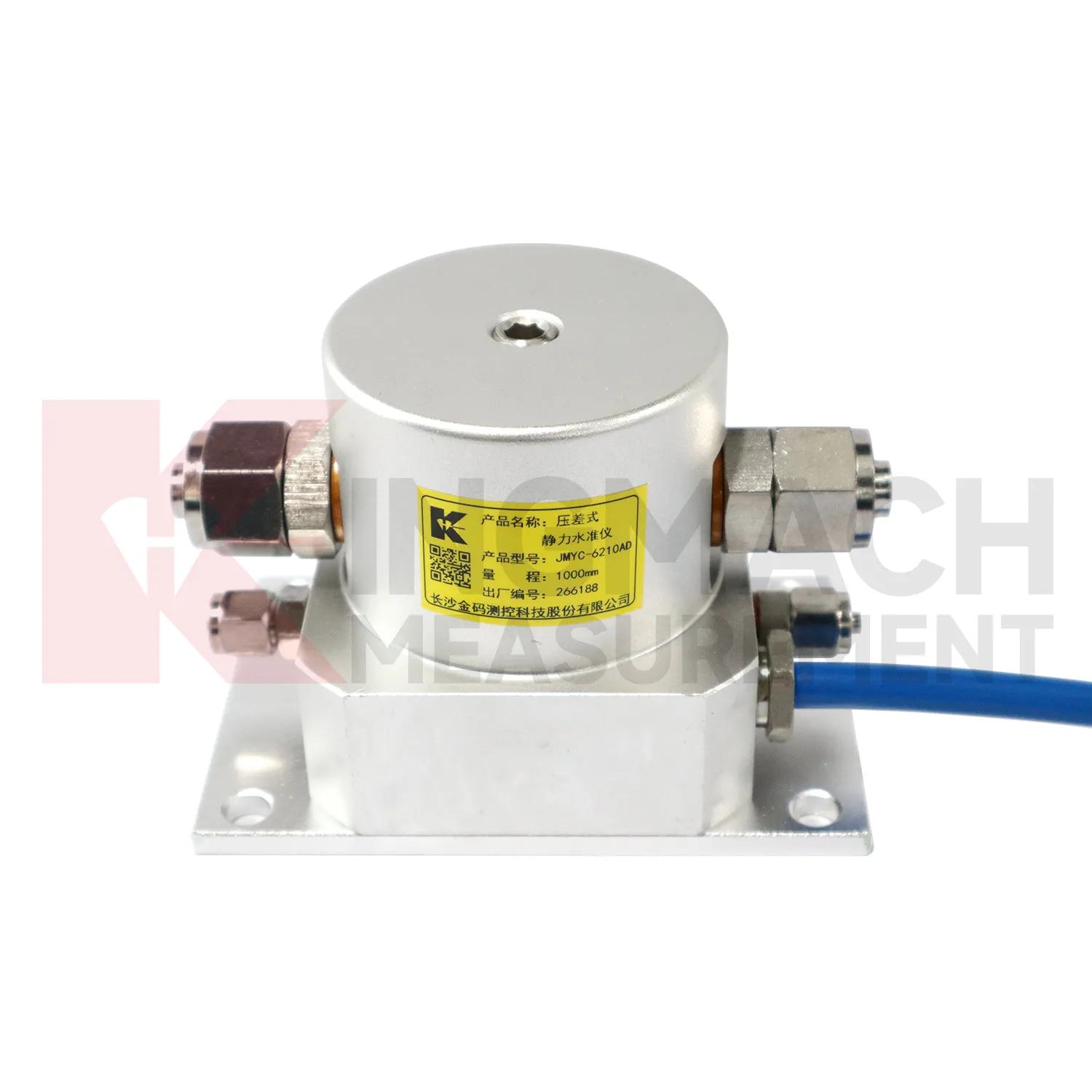
Kingmach Inclinometer-based Hydrostatic Leveling System
Hydrostatic Inclinometer-based Hydrostatic Leveling System are useful when several vertical movement points must be compared against a reference rather than read as isolated values. Kingmach JMDL-62XXADT and JMQJ-62XXADT use connected liquid paths and digital output to monitor vertical deformation in structures such as bridges, dams, tunnels, large buildings, and subgrades. The JMDL-62XXADT lists 50 mm, 100 mm, and 200 mm ranges with 0.01 mm resolution and RS485 output. The JMQJ-62XXADT micro range hydrostatic level sensor lists 50 mm and 100 mm ranges, 0.01 mm resolution, RS485 signal, and IP68 protection. These products are most useful when the tube route, reference point, cabinet, and baseline are documented clearly. If the reference is unstable, every curve downstream becomes harder to trust. A good point record also names the reference location, installation elevation, data channel, and maintenance access so later readings can be checked without guesswork. A good point record also names the reference location, installation elevation, data channel, and maintenance access so later readings can be checked without guesswork.
FAQ
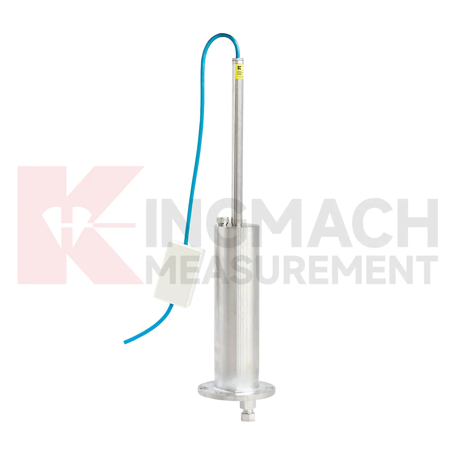
Q: What is JMCJ-1003/1005 used for?
A: It is used to measure layered underground settlement and groundwater level in foundations, subgrades, foundation pits, embankments, and underground structures.
Q: How does magnetic ring settlement reading work?
A: Magnetic rings are placed underground; when the probe senses a ring, audible and visual alerts help the operator read depth from the steel tape at the borehole.
Q: How is water level detected?
A: The water level component works by water conductivity and alerts when the probe contacts water.
Q: What accuracy is listed?
A: The listed measurement accuracy is plus or minus 1 mm.
Q: What field records are needed?
A: Keep borehole number, magnetic ring depth, previous reading, current reading, groundwater level, and operator notes together.
Reviews
Matthew Garcia
Instrumentation cables are durable and perform well even in harsh environments. Will definitely order again.
Ryan Lewis
Fast delivery and excellent product quality. The accelerometers and tiltmeters are highly reliable. Strongly recommend this company.
Latest Inquiries
To protect the privacy of our buyers, only public service email domains like Gmail, Yahoo, and MSN will be displayed. Additionally, only a limited portion of the inquiry content will be shown.
Sophia***@gmail.comUnited Kingdom
Good day, we need environmental monitoring sensors including temperature, humidity, and wind sensors...
Olivia***@gmail.comUnited States
Hello, we are currently sourcing high-precision strain gauges and load cells for a bridge monitoring...